By Eric Thum, CV Years 1966-71
The Broken Skull River is a small alpine tributary of the South Nahanni River. It starts high in the Mackenzie Mountains, the traditional home of the Dehcho First Nations. Before 2015, there were just two known groups who paddled the entire river. The South Nahanni River is famous for several reasons, one being that its spectacular Virginia Falls is higher than Niagara Falls. There are stories abound about gold prospectors who never returned from searching the upper regions of the river. The entire watershed is now the Nahanni National Park Reserve. And in 1978, it was declared a United Nations World Heritage Site. These are all good reasons to plan a canoe trip down both rivers! Our trip was from June 23-July 12, 2023, spanning 14 days and 166 miles.

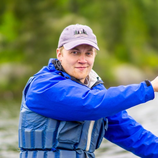
Jason Little, Bob DuGray, Matt Hopkinson, Richard Crowley, Bob Latshaw, and I flew from Boston to Whitehorse, via Toronto and Vancouver. With rented Esquif canoes, pack barrels, bear spray, and other supplies from the local outfitter, we took a six-hour van ride north to Mayo, a village in the Yukon. Here, all our canoes and equipment had to be weighed before boarding a Havilland Turbo Otter for our flight to Divide Lake and the start of the Broken Skull. The two-hour flight over massive mountain ranges was breathtaking. Once we landed at the peaceful Divide Lake and got our gear and canoes off the plane, we took a few hours to hike up Fossil Ridge (2.6 miles) to see our route way off in the distance—Divide River to Broken Skull. From Broken Skull, we’d go to the South Nahanni River, ending at Virginia Falls. Incredible view!
On Tuesday, we started our trip by dragging the canoes down shallow Divide Creek. After portaging around Swallow Falls and Thank You Rapids (and spotting a family of ptarmigans), we reached the confluence of the Broken Skull. Here, we threw tobacco leaves in the water and prayed to the great spirit for safe passage. Our campsite that night was located river right in a large field. Swallows flew overhead.
Wednesday was jam-packed with class II-III rapids, including the tricky Pin Ball Rapids. The bowman would have to do a strong left draw stroke to get the canoe around two large boulders. We didn’t want to risk it. So, after much time scouting the lower section, the decision was made to line the canoes rather than trying to shoot the rapids and possibly dumping in the frigid water. That night, we camped close to the river at the confluence of Whitewater Creek.
Thursday, I awoke to the smell of cowboy coffee percolating over the fire. The skies were very dark and ominous. After an oatmeal breakfast, I took a walk along Whitewater Creek. I found some deer tracks. I admired the finely polished rocks, smooth from thousands of years of rushing water. Later that day, Bob called an emergency meeting. He’d received a message on his Garmin InReach from the Nahanni Park Ranger. The forecast called for over six inches of rain—flash flood conditions. Due to the topography of the area, water levels could rise and fall rapidly with no warning. The message also said to move to high ground as soon as possible. We quickly packed our gear in the canoes and started downriver. We ran continuous class II rapids for several hours, searching for a suitable campsite. Finally, we decided on a site straight up a steep bluff. At twilight, it was hard to see a way to get our canoes and packs high on the plateau, but after much effort, we cleared a site, put up the tents, and stowed our gear under the canoes. We skipped dinner and crawled into our tents with the sound of rain pounding on our tents. Nearby, I could hear landslides cascading down the high mountains surrounding us.
For the next two days, we stayed at this miserable campsite while waiting for the river levels to drop. The only highlight was a grizzly bear and cub crossing the river very close to our site. For a while, it looked like the cub was going to be washed downriver, but the mother was able to grasp Junior by the neck and pull the cub to shore.
Sunday, we decided to continue our trip downriver. Water levels were still high, but manageable. The next dilemma was how to shoot “Mini Gate,” a sharp right-hand turn in class III rapids. If the canoe didn’t make the turn in time, it would slam into a large wall of towering rock. After considerable debate, Bob and Rich decided to line the canoe down close to the wall and paddle straight, full steam ahead. They didn’t get far. The strong current dumped the canoe in a matter of seconds. But both canoeists had dry suits, and their packs were securely tied to the gunwales. They floated through, unharmed. Jason and Bob decided to canoe straight down the current. At the turn, Bob (in the bow) applied a strong right draw stroke as Jason did the sweep in the stern. Success! We did the same and breathed a strong sigh of relief.
Monday, we reached the famed South Nahanni River. The Ragged Range Mountains towered 10,000 feet above us. This range is named for the spectacular formation of jagged peaks that pierce the skyline. The range was formed 110 million years ago when molten igneous rock pushed sedimentary rock up from below. The last period of glaciation sculpted this awesome formation. The river was much wider at this point and silt-laden. On the fourth, Bob tied an American flag to our rain tarp to celebrate Independence Day.
For the next three days, we followed the twisty river and camped on gravel shores. On July 8th, we reached the spectacular Virginia Falls and ranger station—the end of our trip. The float plane was scheduled to pick us up the next day, so there was plenty of time to view and take pictures of the falls. There was a long boardwalk, then a series of switchbacks to the bottom for more photos and a view downriver of the fabled South Nahanni. We could feel the mist from the pounding waters. The next day, we loaded our gear and canoes on the float plane for the three-hour flight back to Whitehorse.
The Broken Skull/South Nahanni River canoe route is known around the world as a premier wilderness river trip. It has all the components of a remote epic adventure: only accessible by float plane, long stretches of class I-IV rapids, wildlife (including black bear), hot springs, views of towering mountains, few portages, and hiking opportunities. If you are considering this trip, please contact me for more details.


You might also like:
- Alumni Complete Canoe Trip Expedition in the Wilds of Canada by Eric Thum
- A Brief History of the Fur Trade by Harrison Pratt
- Paddling Through Time: History and Fishing along the Four Mile Portage by Alex Kvanli